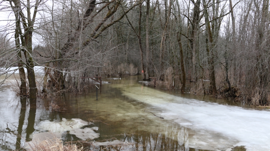
Flooded trails next to the Little River in Canton - March 11th, 2016.
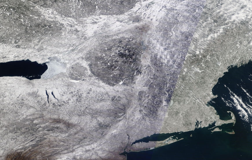
NASA Worldview image of the Northeastern US on March 12th, 2015. One year ago the North Country was still blanketed in snow.
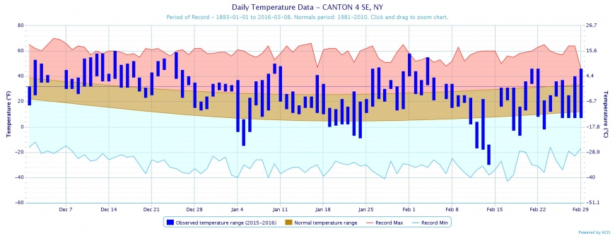
Summarized winter temperatures for Canton, December 1st - February 29th.


Snowbirding in St. Lawrence County: the Balmy Winter of 2016
Have you ever wondered what it would be like to retire and become a snowbird—move south for the winter, maybe Florida or South Carolina, dodge the winter bullet? Heck, some of you might be reading this from those warmer climes, wondering about the winter you missed out on.
In short, we’re coming out of the 2nd warmest winter on record.
Well, for those of you wondering about snowbirding your way out of harsh North Country winters, you just had a taste of a Valley City, North Carolina winter. That’s some 70% of the distance to Florida, and you didn't have to leave the county! If you are more inclined to the upper south/Midwest, you just experienced a Kansas City, Missouri or an Indianapolis, Indiana winter.
First off, why are we talking about "winter" as if it has ended? Doesn't it end on March 21st every year? Yes, astronomically, it’s got another two weeks, but climatologically, it ended on February 29th. In order to more easily manage weather data from the thousands of weather stations, climatological winter is defined as the months of December, January and February. In this way, you can easily manage and manipulate the weather data based on the monthly format. Hey, psychologically too, I think we begin "feeling winter" around the beginning of December and "shut it down" come the first of March (at least I do).
So, what is a regular winter like in the big county? Well, if you could snapshot a regular-old Christmas Day, you'd be estimating the average high and low for the entire winter season (that's and average high of 28oF and low of 9oF). This winter, however, was much, much warmer. Here we’ll put this winter in context based on over 80 years of records from the Canton Township, and also take a look ahead.

If we look at average high temperatures, this past winter was the 2nd warmest on record. If you were here during the 2001-02 season, you might not be surprised, as it was the warmest. Over the long-term, we have seen a 2.7-degree Fahrenheit increase in average high temperature in the past century.

If we look at overall average temperature (the mean of average high and average low), we see again that this was the 2nd warmest winter on record. That 2001-02 season was quite toasty! Over the long term, our average temperatures are, again, warming at a rate of about 1.5 degrees Fahrenheit per century.

Looking at average low temperatures we lose some traction, ranking 3rd all time. Surprisingly, our long-term trend here is more-or-less flat, but technically, we are cooling our average lows by about 1 degree Fahrenheit per century. Why is this? One possibility is that hyper cold periods, such as our record-cold February (2015 at 3.3 average temperature) or hyper/near-record cold nights (Valentine’s weekend, 2016, -29 at my place; record set at the Watertown Airport at -37) is outweighing any net gain in temperatures. So our days may be warmer, but we can still plan on some clear, calm and hyper-cold nights!
What does this all mean?
In summary, our winters are getting warmer by some 1.5 degrees Fahrenheit in the past century. That doesn’t sound like much, but consider this: since the 1920s we have lost two weeks of sub-freezing temperatures (<32 degrees) during this 12-week period (in other words, 15% more of our "winter" is now above freezing or “muddy”)! This warming means one thing - our early and late winter times are collapsing in and becoming more "mud" like. The core of our winters (January) is more or less the same.
Overall, we are experiencing a shorter sub-freezing winter that is becoming wetter with both rain and snow. More rain in the early and late part of the season (December/February) and more snow in the heart of winter (January).

This makes sense, as we warm, our atmosphere will be able to hold more moisture (think the opposite, those hyper-cold, dry days/nights at -20 and your skin yearning for moisture), which has been leading to a net increase in snowfall in the area. This past year was not a snowy one, but we are getting some 18 more inches of snow than when the record period began (the 1920s). At this rate, some 22 inches increase over the past century, we can count on snowy winters, but ones with “heavy” snows and back-breaking shoveling. These will most often be centered, more or less, during the heart of the winter. White Christmases and snowy spring breaks are becoming a thing of the past.
As for this coming spring and summer, who knows what we can expect? I can imagine only one thing—BUGS! It remains to be seen, but there has been little to “kill off” bugs this winter – I’ve even heard of dog owners removing ticks during January!
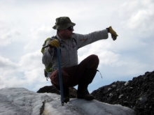
Dr. Stewart is a geology professor at St. Lawrence University who works on surficial-geological problems. Along these lines, he has developed a tree-ring laboratory at St. Lawrence University looking into historical and pre-historical climate by using stands of white pines and hemlocks in and around the Adirondacks. Interestingly, he and his students are “digging” deeper using barn beams to extend their knowledge of climate and forest structure into the 15th and 16th Centuries. He is also a veteran of the US Army.