Remnants of the Past - What the Ice Age Left Behind
I was recently on a walk in the woods with a group of friends when we happened upon a huge rock. Now, this was no ordinary rock. At least 15 feet high and double that wide, this rock was bordering on boulder status. It cut a stark contrast to the white pine and black cherry stands around us, and I couldn’t help but wonder, ‘How does a rock this massive end up in the middle of a forest?’ Luckily for me, one of my friends who knows quite a bit more about geology than I did had an answer - glacial erratics. You may be wondering, ‘What is an erratic? What do glaciers have to do with big rocks? Why are we even talking about glaciers in the middle of the summer?’ Well, this is the best time of year to see the signs left behind from one of the coldest and iciest periods of the North Country’s history.
To understand the history of glaciers in the North Country, we must go back in time. Specifically, we must go back 100,000 years to the Pleistocene, a geologic era you may know better as the Earth’s most recent Ice Age. During this time, most of Canada, the northern U.S., and parts of Greenland were covered by a major ice sheet called the Laurentide Ice Sheet. This ice sheet was up to 2 miles thick at its peak, a time known as the Last Glacial Maximum. Imagine this - if you were here in the North Country 25,000 years ago, you would be standing on top of 10,000 feet of ice! The ice melted about 12,000 years ago, ending the Pleistocene and allowing humans to move back into Upstate New York, create agricultural systems, and eventually build towns and cities. Although the glaciers are gone, we can still see the evidence of them all around us, reminding us of our geologic past here in St. Lawrence County.
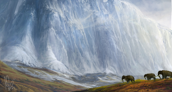
An artist’s rendition of the Laurentide Ice Sheet; Image credit: Ryan Anelowe
When glaciers advance, they ‘pick up’ and move almost everything in their path. As glaciers flow across land, they scrape and freeze onto chunks of bedrock, then carry these pieces of rock hundreds of miles away from their source. When the glaciers melt, it leaves behind deposits of rock and soil that are geologically quite different from the surrounding environment. The large boulders and rocks left behind by receding glaciers are known as glacial erratics and are useful in revealing the paths of ancient glaciers. Glacial erratics are characterized by a relatively smooth appearance after thousands of years of being grounded across ice and bedrock. Some readers may recognize this erratic found on the side of Rte. 56 in South Colton. This massive rock has a long history in the North Country that began thousands of years ago inside a glacier. Today, it is covered in graffiti and paint and is a recognizable landmark for those driving through the southern part of the county. Glacial erratics have a long history of being used as navigational points by humans because of their distinctness from the rest of the landscape! There are many other places throughout St. Lawrence County where glacial erratics can be spotted. Keep an eye out while driving, and you may spy some on the sides of the road! You can also find them while hiking - look out for smooth, out-of-place rocks that have straight-line scratches called striations.
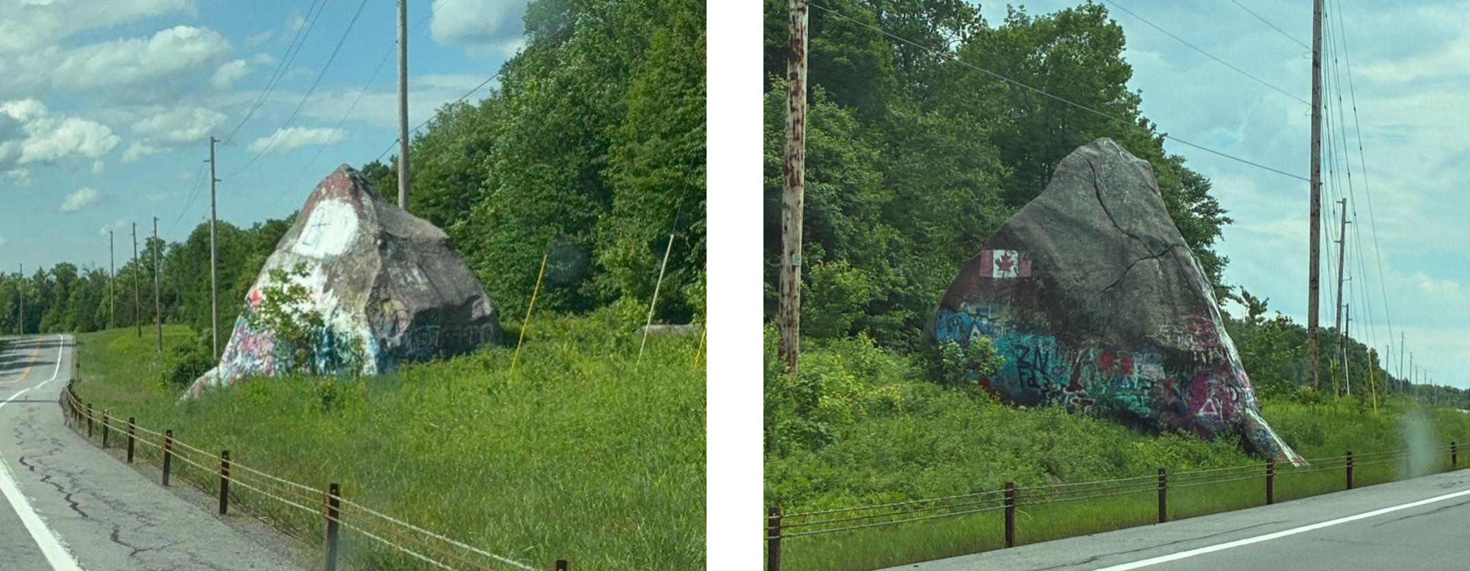
A large glacial erratic that can be seen on Rte. 56 past South Colton. Large boulders left behind from glaciers thousands of years ago symbolize our geologic past! Image credit: Laine Stuard
Glacial striations are another way to observe the travel of glaciers across the land. They are defined as linear scratches, gouges, or grooves that are carved into the bedrock by the rocks and debris frozen at the base of a moving glacier. The immense weight and movement of the ice cause parallel scratches in the direction the glacier is moving. We can observe some of these striations here in St. Lawrence County! Brasie Corners has exposed bedrock with clear glacial striations that can be seen when hiking at Ferrone Woods Preserve. Similarly, the Mount Arab trail is home to a large glacial erratic about halfway up that shows clear striations. By looking at these lines, we can observe the direction the Laurentide Ice Sheet was moving, as well as the size and thickness of the glacier.
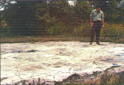
Glacial striations etched into Potsdam sandstone just outside of Brasie Corners, NY. The geologist is John Cecil, photographed in September, 1970. Image credit: Potsdam Public Museum
Another even larger remnant of glaciers is eskers. Eskers are long ridges of sand and gravel formed by streams and rivers that flowed through tunnels within or beneath glaciers. When ancient glaciers receded here in St. Lawrence County, sediments that were left behind from these tunnels formed what look like inverted river channels across the landscape. One of the most famous eskers in our area exists on Massawepie Lake! If you are visiting the lake, you drive on top of the esker to get there. The esker separates the lake from Long Pond. Massawepie is also home to other kinds of glacial evidence. The Massawepie Mire, the largest peatland bog in New York, is only able to exist because of its location in a glacial basin. Next to the esker is another type of glacial evidence called a kettle, which is formed when giant chunks of ice detach from a glacier and become embedded in soil. When the ice eventually melts, it leaves behind a pit filled with water. Round Pond, right between Catamount Pond and Long Pond, is a great example of a kettle. Unfortunately, Massawepie is closed to the public over the summer for summer camps, but is a great spot to see remnants of glaciers in the spring and fall!
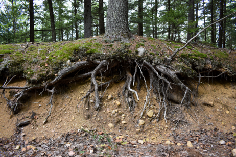
A view of the ‘inside’ of an esker at Massawepie Lake. You can observe the buildup of sand and gravel left behind from glaciers! Image credit: Janelle Jones; Tupper Lake
Our geologic history is all around us and can be observed by anyone! When you go on adventures around the county, you can spot evidence of the glaciers that once towered 2 miles in the air. Look out for large erratics, sandy ridges, and striations, and imagine what the North Country may have looked like thousands of years ago.